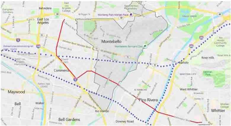
Project map.The route is marked on the map by the red line.Route starts at 3rd Street and Atlantic Boulevard in East L.A., goes south down Atlantic to Telegraph Road, then east down Washington Blvd through to the city of Whittier. Existing rail lines are depicted by blue dotted lines.